
Bild:Odisha locator map.svg

Originaldatei (SVG-Datei, Utgangsgrött: 2.269 × 2.241 Pixel, Dateigrött: 211 KB)
| Disse Datei warrt direkt vun Wikimedia Commons inbunnen. Angaven to'n Autor un de Lizenz staht op de Sied to de Datei bi Commons. |
| Originaltitel |
Orissa locator map |
||
| Beschreibung |
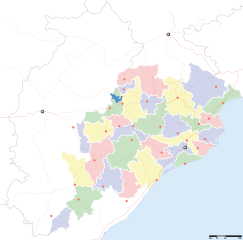
Locator map for the Indian state of w:Orissa. Equirectangular projection - Geographic limits of the map: top=24.27, bottom=17.691 |
||
| Datum/Tiet | |||
| Born |
Egen Wark |
||
| Maker |
|
||
| Lizenz/Verlööv (Disse Datei annerwegens bruken) |
Ik, Autor vun disse Datei, geev ehr hiermit ünner disse Lizenz free: Disse Datei is verfögbar ünner de Creative Commons Attribution-Share Alike 3.0 Unported Afspraak.
|
||
| Kartografische Angaben | |||
| Abgebildetes Datum | 2. Helft vun 20. Johrhunnert un 21. Johrhunnert | ||
| Georeferenzierung | If inappropriate please set warp_status = skip to hide. | ||
| Archivalische Angaben | |||
| Notizen | Part of WikiProject India Maps | ||
Datei-Historie
Klick op de Tiet, dat du de Datei ankieken kannst, so as se do utseeg.
| Datum/Tiet | Duumnagelbild | Grött | Bruker | Kommentoor | |
|---|---|---|---|---|---|
| aktuell | 19:28, 6. Sep. 2008 | | 2.269 × 2.241 (211 KB) | Planemad | |
| 15:28, 21. Feb. 2008 |  | 647 × 564 (132 KB) | Mkeranat~commonswiki | {{Information |Description=Locator map for the state of [w:Orissa] updated to show white borders for districts |Source=self-made, based on India locator map by [w:User:Planemad] |Date=Feb 2008 |Author= Mkeranat |Permission= |other_versions= }} | |
| 23:32, 14. Feb. 2008 |  | 647 × 564 (130 KB) | Mkeranat~commonswiki | {{Information |Description=Locator map for the state of [w:Orissa] |Source=self-made, based on India locator map by [w:User:Planemad] |Date=Feb 2008 |Author= Mkeranat |Permission= |other_versions= }} |
Dateibruuk
Kene Siet bruukt dat Bild.
Allmeen Datei-Bruuk
Disse annern Wikis bruukt disse Datei:
- Bruuk op ar.wikipedia.org
- Bruuk op as.wikipedia.org
- Bruuk op awa.wikipedia.org
- Bruuk op ba.wikipedia.org
- Bruuk op ceb.wikipedia.org
- Bruuk op de.wikipedia.org
- Bruuk op en.wikipedia.org
- Bruuk op es.wikipedia.org
- Bruuk op fa.wikipedia.org
- Bruuk op gu.wikipedia.org
- Bruuk op hi.wikipedia.org
- नलबण पक्षी अभयारण्य
- साँचा:ओड़िशा के लोकसभा निर्वाचन क्षेत्र
- आस्का लोक सभा निर्वाचन क्षेत्र
- भुवनेश्वर लोक सभा निर्वाचन क्षेत्र
- बलांगिर लोक सभा निर्वाचन क्षेत्र
- कटक लोक सभा निर्वाचन क्षेत्र
- ढेंकानाल लोक सभा निर्वाचन क्षेत्र
- जगतसिंहपुर लोक सभा निर्वाचन क्षेत्र
- जाजपुर लोक सभा निर्वाचन क्षेत्र
- कलाहांडी लोक सभा निर्वाचन क्षेत्र
- कंधमाल लोक सभा निर्वाचन क्षेत्र
Kiek na mehr almeen Bruuk von disse Datei.