
Bild:McMurdo Dry Valleys from Antarctic topographic reconnaissance maps (USGS-NSF).jpg

Grött vun disse Vörschuu: 797 × 599 Pixels. Anner Oplösungen: 319 × 240 Pixels | 638 × 480 Pixels | 1.021 × 768 Pixels | 1.280 × 963 Pixels | 2.560 × 1.925 Pixels | 3.032 × 2.280 Pixels.
Originaldatei (3.032 × 2.280 Pixel, Grött: 1,93 MB, MIME-Typ: image/jpeg)
| Disse Datei warrt direkt vun Wikimedia Commons inbunnen. Angaven to'n Autor un de Lizenz staht op de Sied to de Datei bi Commons. |
.jpg)
Beschrieven
| Beschrievung |
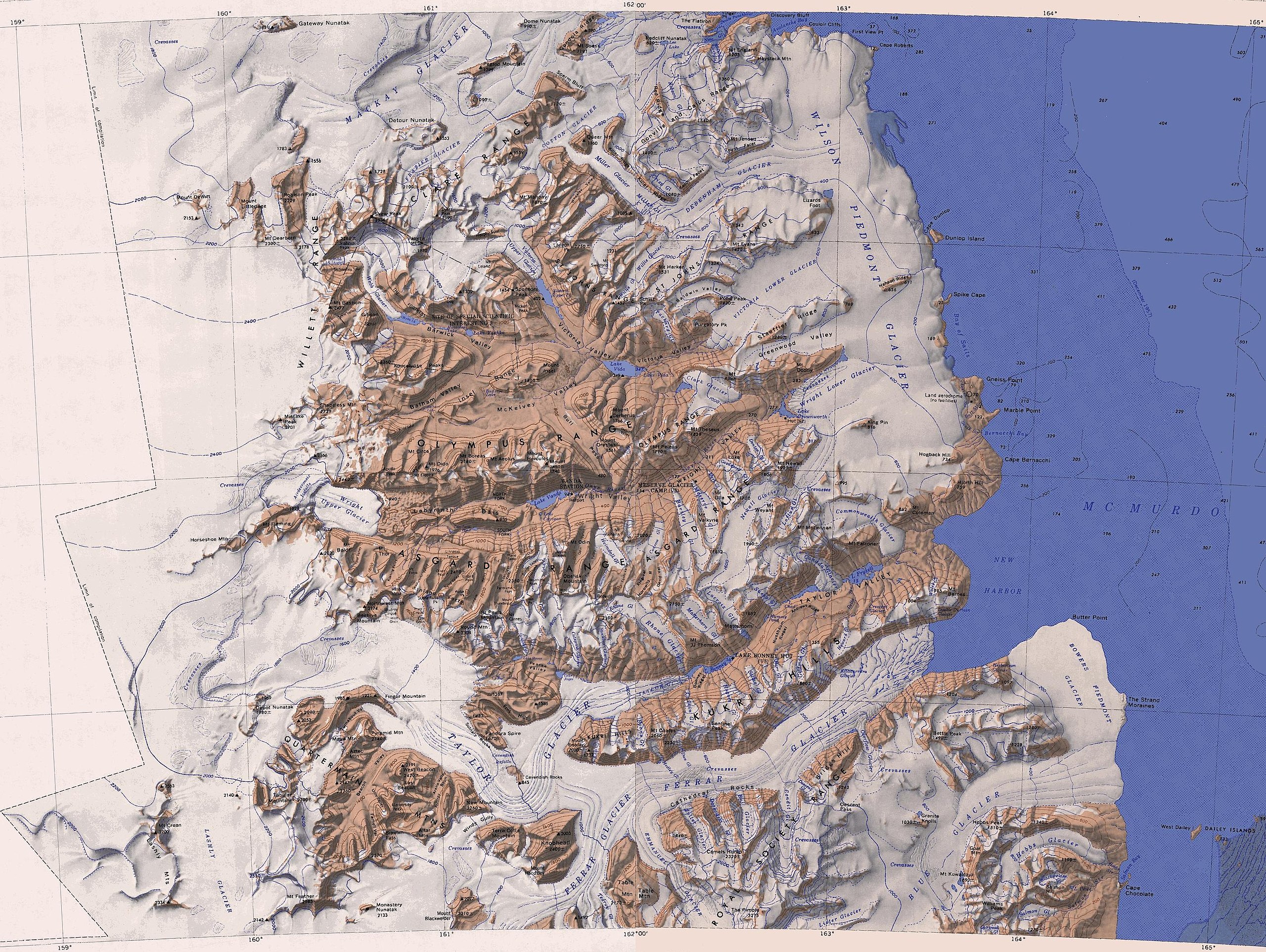
English: Map of the McMurdo Dry Valleys merged from two 1:250,000-scale topographic reconnaissance maps published by the U.S. Geological Survey in cooperation with the National Science Foundation, both compiled in 1962 (the western half revised in 1988, the eastern half in 1970). It comprises the area from 77° to 78° South and approximately 158° to 165° East |
| Datum/Tiet | (revised in 1988 and 1970) |
| Born |
Diese Datei wurde von diesen Werken abgeleitet: |
| Autor | Olaf Studt |
Lizenz
Dieses Bild ist gemeinfrei (public domain), weil es Materialien beeinhaltet, die ursprünglich vom United States Geological Survey, einer Behörde des Innenministeriums der Vereinigten Staaten, stammen. Weitere Informationen finden Sie in den Urheberrechtsbestimmungen des USGS
|
Datei-Historie
Klick op de Tiet, dat du de Datei ankieken kannst, so as se do utseeg.
| Datum/Tiet | Duumnagelbild | Grött | Bruker | Kommentoor | |
|---|---|---|---|---|---|
| aktuell | 15:37, 8. Nov. 2017 | | 3.032 × 2.280 (1,93 MB) | Olaf Studt | {{Information |Description ={{en|1=Map of the McMurdo Dry Valleys merged from two 1:250,000-scale topographic reconnaissance maps published by the U.S. Geological Survey in cooperation with the [[:en:National Science... |
Dateibruuk
Disse Sied bruukt dit Bild:
Allmeen Datei-Bruuk
Disse annern Wikis bruukt disse Datei:
- Bruuk op bg.wikipedia.org
- Bruuk op de.wikipedia.org
- Bruuk op en.wikipedia.org
- Bruuk op www.wikidata.org
.jpg)