
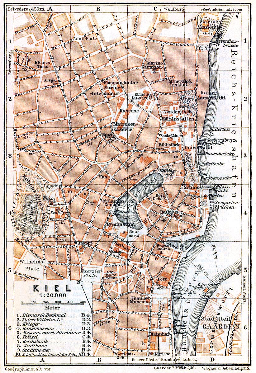
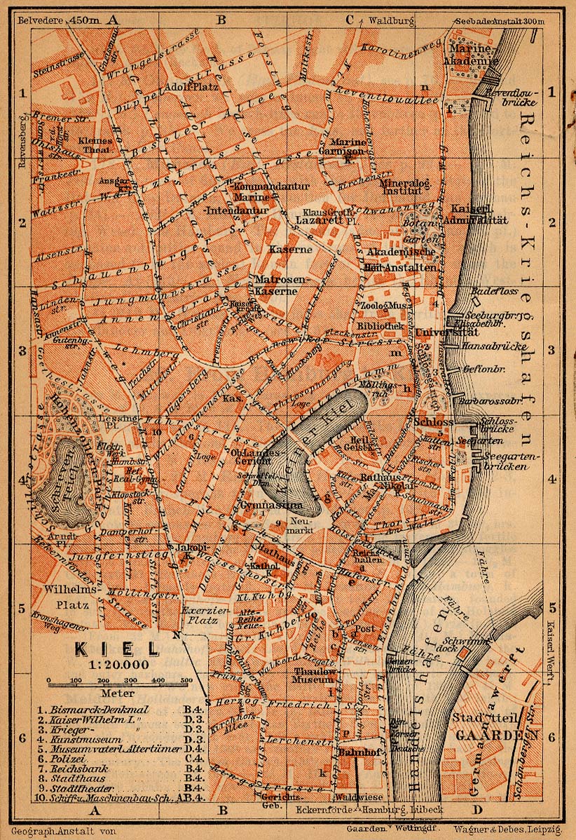
Bild:Map kiel 1910.jpg
Originaldatei (822 × 1.198 Pixel, Grött: 426 KB, MIME-Typ: image/jpeg)
| Disse Datei warrt direkt vun Wikimedia Commons inbunnen. Angaven to'n Autor un de Lizenz staht op de Sied to de Datei bi Commons. |
Beschrieven
| Beschrievung | City map of Kiel, Germany, 1910 |
| Datum/Tiet | |
| Born | http://www.lib.utexas.edu/maps/historical/baedeker_n_germany_1910/kiel_1910.jpg |
| Autor | "Northern Germany as far as the Bavarian and Austrian Frontiers; Handbook for Travellers" by Karl Baedeker. Fifteenth Revised Edition. Leipzig, Karl Baedeker; New York, Charles Scribner's Sons 1910. |
| Lizenz/Verlööv (Disse Datei annerwegens bruken) |
"Courtesy of the University of Texas Libraries, The University of Texas at Austin." http://www.lib.utexas.edu/maps/map_sites/hist_sites.html |
Lizenz
|
Disse Datei is gemeenfree. Dat gellt för all Länner, bi de dat Oorheverrecht na Levenstied plus 70 Johr oder weniger utlöppt.
| |
| Es wurde festgestellt, dass diese Datei frei von bekannten Beschränkungen durch das Urheberrecht ist, alle verbundenen und verwandten Rechte eingeschlossen. | |
Datei-Historie
Klick op de Tiet, dat du de Datei ankieken kannst, so as se do utseeg.
| Datum/Tiet | Duumnagelbild | Grött | Bruker | Kommentoor | |
|---|---|---|---|---|---|
| aktuell | 01:33, 27. Mai 2006 | | 822 × 1.198 (426 KB) | 700 MB | even more |
| 01:23, 27. Mai 2006 |  | 822 × 1.198 (572 KB) | 700 MB | tried to remove the stain | |
| 03:49, 23. Apr. 2006 |  | 822 × 1.198 (442 KB) | 700 MB | {{Information| |Description=City map of Kiel, Germany, 1910 |Source=http://www.lib.utexas.edu/maps/historical/baedeker_n_germany_1910/kiel_1910.jpg |Date=1910 |Author="Northern Germany as far as the Bavarian and Austrian Frontiers; Handbook for Travellers |
Dateibruuk
Disse Sied bruukt dit Bild:
Allmeen Datei-Bruuk
Disse annern Wikis bruukt disse Datei:
- Bruuk op de.wikipedia.org
- Bruuk op de.wikivoyage.org
- Bruuk op nn.wikipedia.org
- Bruuk op no.wikipedia.org