
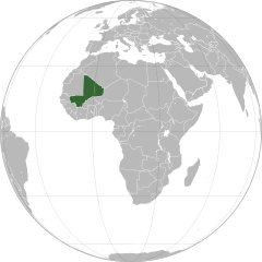
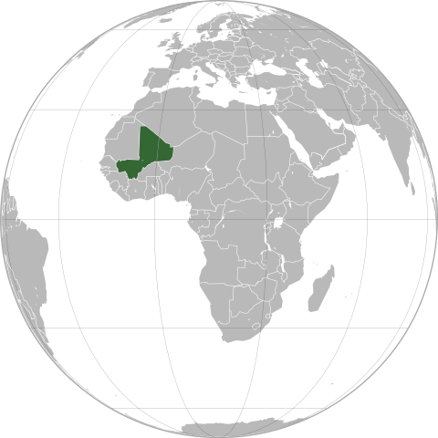
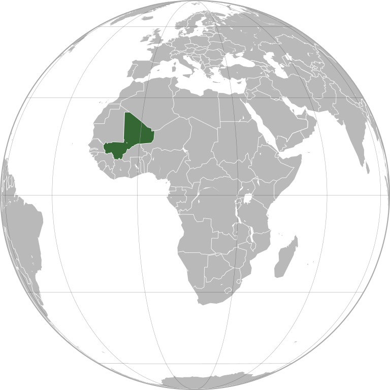
Bild:Mali (orthographic projection).svg

Größe der PNG-Vorschau dieser SVG-Datei: 550 × 550 Pixels. Anner Oplösungen: 240 × 240 Pixels | 480 × 480 Pixels | 768 × 768 Pixels | 1.024 × 1.024 Pixels | 2.048 × 2.048 Pixels.
Originaldatei (SVG-Datei, Utgangsgrött: 550 × 550 Pixel, Dateigrött: 83 KB)
| Disse Datei warrt direkt vun Wikimedia Commons inbunnen. Angaven to'n Autor un de Lizenz staht op de Sied to de Datei bi Commons. |
je besoin de kate
Beschrieven
| Beschrievung |
English: Mali (orthographic projection)
Português: Mali (projeção ortográfica)
Español: Mali (proyección ortográfica) |
||
| Datum/Tiet | |||
| Born | Egen Wark | ||
| Autor | Marcos Elias de Oliveira Júnior | ||
| Lizenz/Verlööv (Disse Datei annerwegens bruken) |
|
||
| Annere Versionen |
|
.svg)
.svg)
.svg)
.svg)
.svg)
.svg)
.svg)
.svg)
.svg)
.svg)
.svg)
.svg)
.svg)
.svg)
.svg)
.svg)
.svg)
.svg)
.svg)
.svg)
.svg)
.svg)
.svg)
.svg)
.svg)
.svg)
.svg)
.svg)
.svg)
.svg)
.svg)
.svg)
.svg)
.svg)
.svg)
.svg)
.svg)
.svg)
.svg)
.svg)
.svg)
.svg)
.svg)
.svg)
.svg)
.svg)
.svg)
.svg)
.svg)
.svg)
.svg)
.svg)
.svg)
.svg)
.svg)
.svg)
.svg)
.svg)
.svg)
.svg)
.svg)
.svg)
.svg)
.svg)
.svg)
.svg)
.svg)
.svg)
.svg)
.svg)
.svg)
.svg)
.svg)
.svg)

.svg)

.svg)

.svg)
.svg)
.svg)
.svg)
.svg)
.svg)
.svg)


.svg)
.svg)
.svg)
.svg)
.svg)
.svg)
.svg)

.svg)
.svg)
.svg)
.svg)
.svg)
.svg)
.svg)
.svg)
.svg)
.svg)

.svg)
.svg)
.svg)
.svg)
.svg)
.svg)
.svg)
_without_national_boundaries.svg)
.svg)
.svg)
.svg)
.svg)
.svg)
.svg)

.svg)
.svg)
.png)
.svg)
.svg)
.svg)
.svg)

.svg)
.svg)
.svg)
.svg)
.svg)
.svg)
.svg)
.svg)
.svg)
.svg)
.svg)

.svg)
.svg)
.svg)
.svg)
.svg)
.svg)
.svg)
.svg)
.svg)

.svg)
.svg)

.svg)
.svg)
.svg)
.svg)
.svg)
.svg)
.svg)
.svg)
.svg)
.svg)
.svg)
.svg)
.svg)
.svg)
.svg)
.svg)
.svg)
.svg)
.svg)
.svg)
.svg)
.svg)
.svg)
.svg)
.svg)
.svg)
.svg)
_-_Crimea_disputed.svg)
.svg)
.svg)
.svg)
.svg)
.svg)
.svg)
.svg)
.svg)
.svg)
.svg)
.svg)
_political.svg)
.svg)
.svg)
.svg)
.svg)
_-_Crimea_disputed_-_no_borders.svg)
.svg)
.svg)
.svg)
.svg)
.svg)
.svg)
.svg)
.svg)
.svg)
.svg)
.svg)

.svg)
.svg)
.svg)

.png)
.svg)
.svg)
.svg)
.svg)
.svg)
.svg)
.svg)
.svg)
.svg)
.svg)
.svg)
.svg)
.svg)
.svg)
.svg)
.svg)
.svg)
.svg)
.svg)
.svg)
.svg)
.svg)
.svg)
.svg)
.svg)
.svg)
.svg)
.svg)
.svg)
.svg)
.svg)
.svg)
.svg)
.svg)
.png)
.svg)
.svg)
.svg)
_(orthographic_projection).png)
.svg)
| Orthographic projections maps created by Ssolbergj |
|---|
| Orthographic projections maps created by Ssolbergj: |
.svg)
.svg)
Datei-Historie
Klick op de Tiet, dat du de Datei ankieken kannst, so as se do utseeg.
.svg&dir=prev)
.svg&offset=20120612133023)
.svg&offset=&limit=20)
.svg&offset=&limit=50)
.svg&offset=&limit=100)
.svg&offset=&limit=250)
.svg&offset=&limit=500)
| Datum/Tiet | Duumnagelbild | Grött | Bruker | Kommentoor | |
|---|---|---|---|---|---|
| aktuell | 00:04, 19. Jul. 2022 | | 550 × 550 (83 KB) | M.Bitton | added the missing border between Ethiopia and Eritrea, per request |
| 23:40, 12. Sep. 2012 |  | 550 × 550 (108 KB) | Palosirkka | Scrubbed with http://codedread.com/scour/ | |
| 13:59, 19. Jul. 2012 |  | 550 × 550 (284 KB) | Chipmunkdavis | http://www.france24.com/en/20120712-al-qaeda-linked-islamists-drive-malis-tuaregs-last-stronghold-ansogo-timbuktu-mnla-ansar-dine-mujao MNLA fully removed, Asar Dine does not claim independence. Azawad no longer exists as a state. | |
| 03:19, 2. Jul. 2012 |  | 550 × 550 (236 KB) | Chipmunkdavis | MNLA still claims they control everything outside the three major towns, [http://www.timeslive.co.za/africa/2012/06/30/islamists-destroy-mali-world-heritage-sites]. Discussion ongoing at en:Talk:List of States with Limited Recognition | |
| 19:18, 30. Jun. 2012 |  | 550 × 550 (284 KB) | Aotearoa | Reverted to version as of 22:34, 12 June 2012, Independent Azawad is not existed at the moment (territory under administration of anti-independent Ansar Dine | |
| 23:26, 13. Jun. 2012 |  | 550 × 550 (236 KB) | Chipmunkdavis | Reverted to version as of 14:18, 12 June 2012 Unexplained revert against talk consensus | |
| 00:34, 13. Jun. 2012 |  | 550 × 550 (284 KB) | Boudoul | Reverted to version as of 13:30, 12 June 2012 | |
| 00:34, 13. Jun. 2012 |  | 550 × 550 (284 KB) | Boudoul | Reverted to version as of 13:30, 12 June 2012 | |
| 16:18, 12. Jun. 2012 |  | 550 × 550 (236 KB) | Chipmunkdavis | For most of the countries to which it applies, it is used. See talk page for further discussion. | |
| 15:30, 12. Jun. 2012 |  | 550 × 550 (284 KB) | Boudoul | Outside of central government control will be true for so many countries - that's a ridiculous reason. |
Dateibruuk
Kene Siet bruukt dat Bild.
Allmeen Datei-Bruuk
Disse annern Wikis bruukt disse Datei:
- Bruuk op ace.wikipedia.org
- Bruuk op ami.wikipedia.org
- Bruuk op ang.wikipedia.org
- Bruuk op ar.wikipedia.org
- مالي
- مستخدم:جار الله/قائمة صور مقالات العلاقات الثنائية
- العلاقات الأمريكية المالية
- العلاقات الأنغولية المالية
- العلاقات الكورية الجنوبية المالية
- العلاقات الإريترية المالية
- العلاقات السويسرية المالية
- العلاقات الألمانية المالية
- العلاقات الليختنشتانية المالية
- العلاقات البوليفية المالية
- العلاقات المالية الموزمبيقية
- العلاقات الألبانية المالية
- العلاقات البلجيكية المالية
- العلاقات الإثيوبية المالية
- العلاقات البيلاروسية المالية
- العلاقات الطاجيكستانية المالية
- العلاقات الروسية المالية
- العلاقات الرومانية المالية
- العلاقات الأرجنتينية المالية
- العلاقات الغامبية المالية
- العلاقات القبرصية المالية
- العلاقات السيراليونية المالية
- العلاقات المالية النيبالية
- العلاقات الليبيرية المالية
- العلاقات التشيكية المالية
- العلاقات المالية الميانمارية
- العلاقات العراقية المالية
- العلاقات البريطانية المالية
- العلاقات الكندية المالية
- العلاقات الكوبية المالية
- العلاقات الكورية الشمالية المالية
- العلاقات الكوستاريكية المالية
- العلاقات الكولومبية المالية
- العلاقات الكيريباتية المالية
- العلاقات الكينية المالية
- العلاقات اللاتفية المالية
- العلاقات اللاوسية المالية
- العلاقات اللبنانية المالية
- العلاقات اللوكسمبورغية المالية
- العلاقات الليبية المالية
- العلاقات الليتوانية المالية
- العلاقات الليسوتوية المالية
- العلاقات المالاوية المالية
- العلاقات المالطية المالية
- العلاقات المالية النيجيرية
- العلاقات المالية الناوروية
- العلاقات المالية المصرية
Kiek na mehr almeen Bruuk von disse Datei.
.svg)
.svg)