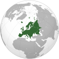
Bild:Europe (orthographic projection).svg

Originaldatei (SVG-Datei, Utgangsgrött: 541 × 541 Pixel, Dateigrött: 239 KB)
| Disse Datei warrt direkt vun Wikimedia Commons inbunnen. Angaven to'n Autor un de Lizenz staht op de Sied to de Datei bi Commons. |
Beschrieven
| BeschrievungEurope (orthographic projection).svg |
العربية: الخريطة الهجائية لأوروبا English: Europe
Français : Europe ქართული: ევროპა |
||||
| Datum/Tiet | |||||
| Born |
Egen Wark
|
||||
| Autor | Ssolbergj | ||||
| Annere Versionen |
Von disse Datei afleidt Warken: Europe orthographic Caucasus Urals boundary.svg العربية: الرجاء، قراءة الميثاق.
বাংলা: দয়া করে, রীতিনীতিটি পড়ুন।
Deutsch: Bitte lies die Konventionen.
English: Please, read the conventions.
Español: Por favor, lea las convenciones.
Filipino: Paki-basa ang mga kumbensyon.
Français : S'il vous plaît, lisez les conventions.
हिन्दी: कृपया सभागमों को पढ़ लें.
Bahasa Indonesia: Silakan, baca konvensi.
Italiano: Si prega di leggere le convenzioni.
日本語: 規約をご確認ください。
ქართული: გთხოვთ, გაეცნოთ კონვენციებს.
Македонски: Ве молиме, прочитајте ги општоприфатените правила.
Português: Por favor, leia as convenções.
Русский: Пожалуйста, прочитайте соглашения.
Tagalog: Paki-basa ang mga kumbensyon.
Українська: Будь ласка, прочитайте конвенції.
Tiếng Việt: Hãy đọc công văn trước khi đăng.
中文(繁體):請檢視常規
中文(简体):请查看常规
|
||||
| SVG‑Erstellung InfoField | De Borntext von dit SVG-Bild is nich krekt von wegen 98 Fehlers. De Borntext von Dit Vektorbild is mit Inkscape opstellt worrn. |
Lizenz
| Public domainPublic domainfalsefalse |
| This map is ineligible for copyright and therefore in the public domain, because it consists entirely of information that is common property and contains no original authorship. For more information, see Commons:Threshold of originality § Maps.
English | Español | Galego | Română | slovenščina | العربية | 简体中文 | 繁體中文 | +/− |
| Annotations InfoField | This image is annotated: View the annotations at Commons |
Poland
Spain
Portugal
Africa
Asia
Norway
France
Italy
America
Moldova
United Kingdom
Russia
Ireland
Greece
Finland
Germany
Denmark
Corsica
Switzerland
Bulgaria
Iceland
Sicilia
Cyprus
Malta
Estonia
Svalbard
Greenland
Sardinia
Albania
Austria
Balearic Islands
Crete
Kurzbeschreibungen
Einige Werte ohne einen Wikidata-Eintrag
Urheberrechtsstatus Düütsch
urheberrechtlich geschützt Düütsch
7. Jan. 2009
MIME-Typ Düütsch
image/svg+xml
Datei-Historie
Klick op de Tiet, dat du de Datei ankieken kannst, so as se do utseeg.
| Datum/Tiet | Duumnagelbild | Grött | Bruker | Kommentoor | |
|---|---|---|---|---|---|
| aktuell | 11:46, 31. Jan. 2016 |  | 541 × 541 (239 KB) | Christina1969 | Reverted to version as of 19:08, 20 June 2009 (UTC) |
| 22:21, 8. Sep. 2013 |  | 541 × 541 (235 KB) | Chipmunkdavis | Reverted to version as of 22:37, 8 July 2009 Restore to version which notes source | |
| 22:11, 12. Sep. 2012 |  | 541 × 541 (82 KB) | Palosirkka | Scrubbed with http://codedread.com/scour/ | |
| 20:44, 4. Apr. 2011 |  | 541 × 541 (235 KB) | Green, White and Gold | Reverted to version as of 22:37, 8 July 2009 | |
| 06:49, 3. Apr. 2011 |  | 541 × 541 (239 KB) | ComtesseDeMingrelie | correcting Phasis riverbank | |
| 06:49, 3. Apr. 2011 |  | 541 × 541 (235 KB) | ComtesseDeMingrelie | more common | |
| 06:44, 3. Apr. 2011 |  | 541 × 541 (235 KB) | ComtesseDeMingrelie | most common definition | |
| 00:37, 9. Jul. 2009 |  | 541 × 541 (235 KB) | Bosonic dressing | rv: yes - per Natl Geographic Atlas of the World, which trumps what might be an original concoction | |
| 15:50, 5. Jul. 2009 |  | 541 × 541 (235 KB) | Ssolbergj | I based the border on http://en.wikipedia.org/wiki/File:Map_of_Europe_(political).png. Do you have a more reliable source? | |
| 21:08, 20. Jun. 2009 |  | 541 × 541 (239 KB) | Bosonic dressing | Europe: orthographic projection - minor tweak of continental border in Caucasus |
Dateibruuk
Kene Siet bruukt dat Bild.
Allmeen Datei-Bruuk
Disse annern Wikis bruukt disse Datei:
- Bruuk op ace.wikipedia.org
- Itali
- Peurancih
- Siprus
- Turuki
- Vatikan
- Iërupa
- Jeureuman
- Rumania
- Hongaria
- Polandia
- Moldova
- Austria
- Bèlgia
- Liechtenstein
- Luksèmburg
- Monakô
- Blanda
- Swiss
- Bèlarusia
- Bulgaria
- Ukraina
- Slowakia
- Rusia
- Denmark
- Swèdia
- Irlandia
- Islandia
- Latvia
- Lithuania
- Finlandia
- Èstonia
- Albania
- Andorra
- Bosnia Hèrzègovina
- Kroasia
- Malta
- Yunani
- Seupanyo
- Sèrbia
- San Marino
- Portugéh
- Monténègrô
- Slovenia
- Norwègia
- Cèkia
- Pola:Iërupa
- Kosovô
- Bruuk op af.wikipedia.org
Kiek na mehr almeen Bruuk von disse Datei.
Metadaten
Disse Datei bargt noch mehr Informatschonen, de mehrsttiets vun de Digitalkamera oder den Scanner kaamt. Dör Afännern vun de Originaldatei köönt welk Details nich mehr ganz to dat Bild passen.
| Breed | 541.47876 |
|---|---|
| Hööchd | 541.47876 |


