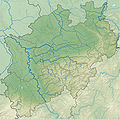
Bild:North Rhine-Westphalia location map 05.svg
Erscheinungsbild

Größe der PNG-Vorschau dieser SVG-Datei: 527 × 524 Pixels. Anner Oplösungen: 241 × 240 Pixels | 483 × 480 Pixels | 772 × 768 Pixels | 1.030 × 1.024 Pixels | 2.060 × 2.048 Pixels.
Originaldatei (SVG-Datei, Utgangsgrött: 527 × 524 Pixel, Dateigrött: 4,42 MB)
Datei-Historie
Klick op de Tiet, dat du de Datei ankieken kannst, so as se do utseeg.
| Datum/Tiet | Duumnagelbild | Grött | Bruker | Kommentoor | |
|---|---|---|---|---|---|
| aktuell | 20:38, 16. Dez. 2009 |  | 527 × 524 (4,42 MB) | TUBS | korr crop area |
| 09:30, 4. Nov. 2008 |  | 654 × 656 (4,91 MB) | TUBS | {{Information |Description= |Source= |Date= |Author= |Permission= |other_versions= }} | |
| 08:36, 9. Okt. 2008 |  | 654 × 656 (4,77 MB) | TUBS | == Summary == {{Information |Description= {{de|Positionskarte Nordrhein-Westfalen, Germany. Geographische Begrenzung der Karte:}} {{en|Location map North Rhine-Westphalia, Germany. Geographic li | |
| 08:28, 9. Okt. 2008 |  | 654 × 656 (4,77 MB) | TUBS | == Summary == {{Information |Description= {{de|Positionskarte Nordrhein-Westfalen, Germany. Geographische Begrenzung der Karte:}} {{en|Location map North Rhine-Westphalia, Germany. Geographic li | |
| 08:19, 9. Okt. 2008 |  | 654 × 656 (4,77 MB) | TUBS | == Summary == {{Information |Description= {{de|Positionskarte Nordrhein-Westfalen, Germany. Geographische Begrenzung der Karte:}} {{en|Location map North Rhine-Westphalia, Germany. Geographic li |
Dateibruuk
Kene Siet bruukt dat Bild.
Allmeen Datei-Bruuk
Disse annern Wikis bruukt disse Datei:
- Bruuk op als.wikipedia.org
- Bruuk op ar.wikipedia.org
- Bruuk op as.wikipedia.org
- Bruuk op awa.wikipedia.org
- Bruuk op cv.wikipedia.org
- Bruuk op da.wikipedia.org
- Bruuk op de.wikipedia.org
- Neandertal
- Münsterland
- Ederkopf
- Hariksee
- Biggetalsperre
- Versetalsperre
- Langenberg (Rothaargebirge)
- Haar (Westfalen)
- Hülser Berg
- Rurtalsperre
- Tomburg
- Grube Anna
- Sengbachtalsperre
- Grube Emil Mayrisch
- Ahauser Stausee
- Burg Linn
- Baumberge
- Naturpark Hohe Mark
- Ronsdorfer Talsperre
- Wahnbachtalsperre
- Wuppertalsperre
- Oleftalsperre
- Vryburg (Denkmal)
- Panzertalsperre
- Isenburg (Hattingen)
- Oestertalsperre
- Jubachtalsperre
- Wiehltalsperre
- Brucher Talsperre
- Kerspetalsperre
- Baldeneysee
- Heilenbecketalsperre
- Schloss Broich
Kiek na mehr almeen Bruuk von disse Datei.


