
Bild:Buenos aires province numbered.png
Grött vun disse Vörschuu: 434 × 599 Pixels. Anner Oplösungen: 174 × 240 Pixels | 347 × 480 Pixels | 556 × 768 Pixels | 741 × 1.024 Pixels | 2.345 × 3.239 Pixels.
Originaldatei (2.345 × 3.239 Pixel, Grött: 9,37 MB, MIME-Typ: image/png)
| Disse Datei warrt direkt vun Wikimedia Commons inbunnen. Angaven to'n Autor un de Lizenz staht op de Sied to de Datei bi Commons. |
Beschrieven
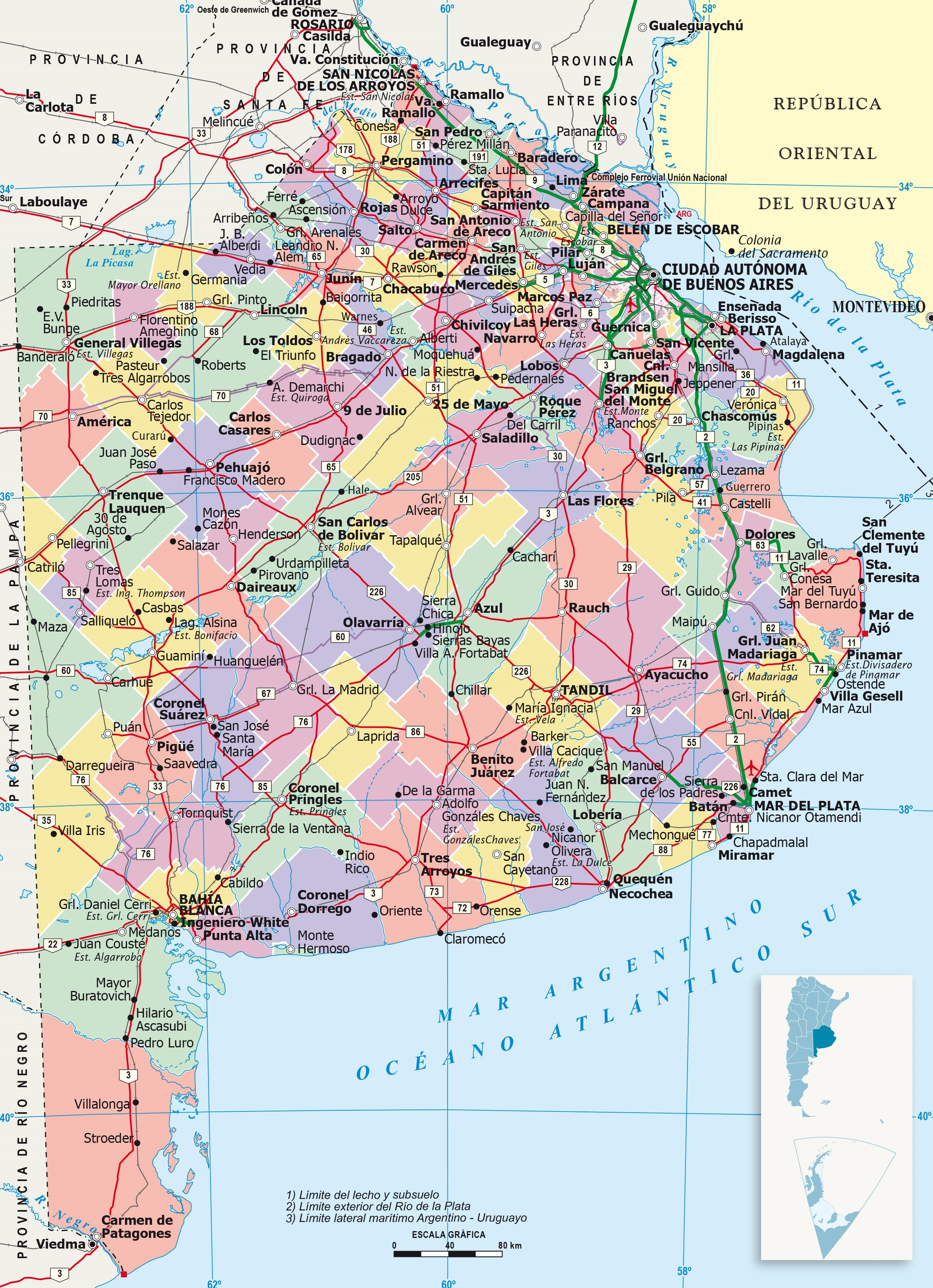
| Beschrievung | It shows administrative division of Buenos Aires province, its capital (red point) and its boundaries. This version has reference numbers for easier locating of provinces. |
| Datum/Tiet | |
| Born | https://www.ign.gob.ar/ |
| Autor | IGN (National Geographic Institute) |
Lizenz
Diese Datei ist lizenziert unter der Creative-Commons-Lizenz „Namensnennung – Weitergabe unter gleichen Bedingungen 4.0 international“.
- Du dröffst:
- wiedergeven – Kopien maken, an Annere wiedergeven un överdregen
- nee tohoopsetten – dat Wark verännern
- Ünner disse Bedingen:
- Naam nömen – Du musst den Naam von’n Autor oder von’n Afspraakgever in de von em fastleggte Wies nömen (aver nich so, dat dat utsüht, as wenn he di oder dien Gebruuk von dat Wark ünnerstütten deit).
- egaal wiedergeven – Wenn du dit Wark ännerst, afwannelst oder in en eegen Wark inboost, dörffst du dat nie’e Wark, dat dor bi rutkummt, man ünner desülve Afspraak oder een, de so temlich dat sülve is, rutgeven.
Lizenz
| Ich, der Urheberrechtsinhaber dieses Werkes, veröffentliche es als gemeinfrei. Dies gilt weltweit. Wenn dat na lokale Rechtslaag nich mööglich is, gellt: Ich gewähre jedem das bedingungslose Recht, dieses Werk für jedweden Zweck zu nutzen, es sei denn, Bedingungen sind gesetzlich erforderlich. |
Datei-Historie
Klick op de Tiet, dat du de Datei ankieken kannst, so as se do utseeg.
| Datum/Tiet | Duumnagelbild | Grött | Bruker | Kommentoor | |
|---|---|---|---|---|---|
| aktuell | 06:45, 23. Jun. 2023 | | 2.345 × 3.239 (9,37 MB) | LibIchtnatz | Updated to a newer and clear version made by the IGN (National Geographic Institution) |
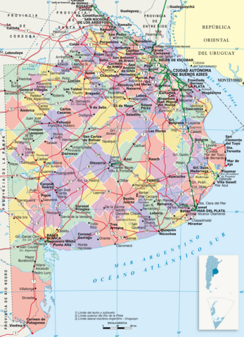
| 05:15, 31. Aug. 2007 |  | 569 × 621 (36 KB) | Joshbaumgartner | == Summary == It shows administrative division of Buenos Aires province, its capital (red point) and its boundaries. This version has reference numbers for easier locating of provinces. == Licensing == {{PD-self}} [[Category:Maps of Buenos Aires Provinc |
Dateibruuk
Disse Sied bruukt dit Bild:
Allmeen Datei-Bruuk
Disse annern Wikis bruukt disse Datei:
- Bruuk op cs.wikipedia.org
- Bruuk op en.wikipedia.org
- Bruuk op fa.wikipedia.org
- Bruuk op fi.wikipedia.org
- Bruuk op fr.wikipedia.org
- Bruuk op hu.wikipedia.org
- Bruuk op it.wikipedia.org
- Bruuk op ja.wikipedia.org
- Bruuk op ko.wikipedia.org
- Bruuk op sk.wikipedia.org
- Bruuk op tr.wikipedia.org
- Bruuk op zh.wikipedia.org