
Bild:Map of Washington highlighting Spokane County.svg

Größe der PNG-Vorschau dieser SVG-Datei: 800 × 521 Pixels. Anner Oplösungen: 320 × 208 Pixels | 640 × 416 Pixels | 1.024 × 666 Pixels | 1.280 × 833 Pixels | 2.560 × 1.666 Pixels | 5.936 × 3.863 Pixels.
Originaldatei (SVG-Datei, Utgangsgrött: 5.936 × 3.863 Pixel, Dateigrött: 215 KB)
| Disse Datei warrt direkt vun Wikimedia Commons inbunnen. Angaven to'n Autor un de Lizenz staht op de Sied to de Datei bi Commons. |
Beschrieven
| Beschrievung |
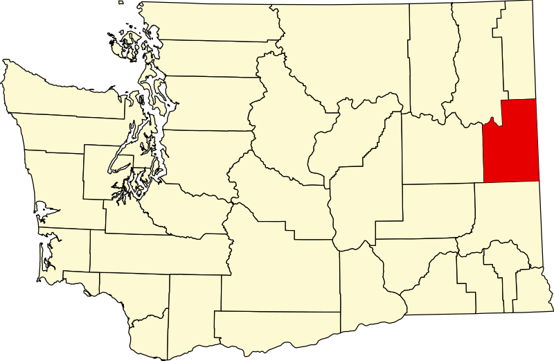
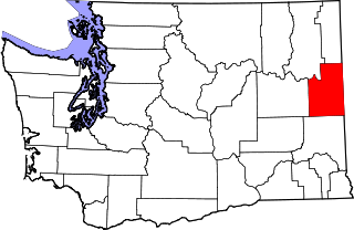
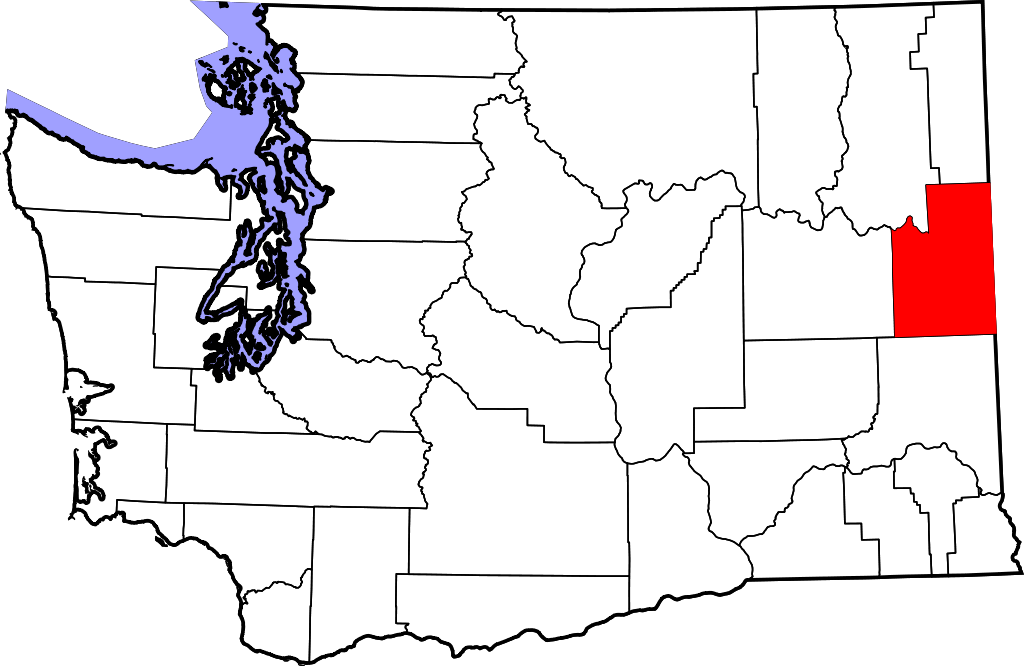
English: This is a locator map showing Spokane County in Washington. For more information, see Commons:United States county locator maps. |
| Datum/Tiet | |
| Born |
Egen Wark: English: The maps use data from nationalatlas.gov, specifically countyp020.tar.gz on the Raw Data Download page. The maps also use state outline data from statesp020.tar.gz. The Florida maps use hydrogm020.tar.gz to display Lake Okeechobee. |
| Autor | David Benbennick |
Lizenz
| Ich, der Urheberrechtsinhaber dieses Werkes, veröffentliche es als gemeinfrei. Dies gilt weltweit. Wenn dat na lokale Rechtslaag nich mööglich is, gellt: Ich gewähre jedem das bedingungslose Recht, dieses Werk für jedweden Zweck zu nutzen, es sei denn, Bedingungen sind gesetzlich erforderlich. |
Datei-Historie
Klick op de Tiet, dat du de Datei ankieken kannst, so as se do utseeg.
| Datum/Tiet | Duumnagelbild | Grött | Bruker | Kommentoor | |
|---|---|---|---|---|---|
| aktuell | 20:06, 12. Feb. 2006 | | 5.936 × 3.863 (215 KB) | David Benbennick | {{subst:User:Dbenbenn/clm|county=Spokane County|state=Washington|type=county}} |
Dateibruuk
Disse Sied bruukt dit Bild:
Allmeen Datei-Bruuk
Disse annern Wikis bruukt disse Datei:
- Bruuk op ar.wikipedia.org
- Bruuk op bg.wikipedia.org
- Bruuk op bpy.wikipedia.org
- Bruuk op ca.wikipedia.org
- Spokane (Washington)
- Airway Heights
- Cheney (Washington)
- Country Homes
- Deer Park (Washington)
- Fairfield (Washington)
- Fairwood (comtat de Spokane)
- Latah (Washington)
- Liberty Lake
- Medical Lake
- Millwood (Washington)
- Otis Orchards-East Farms
- Rockford (Washington)
- Spangle
- Town and Country (Washington)
- Waverly (Washington)
- Plantilla:Comtat de Spokane
- Amber (Washington)
- Bruuk op cdo.wikipedia.org
- Bruuk op ceb.wikipedia.org
- Bruuk op ce.wikipedia.org
- Bruuk op cs.wikipedia.org
- Bruuk op cy.wikipedia.org
- Bruuk op de.wikipedia.org
- Bruuk op en.wikipedia.org
Kiek na mehr almeen Bruuk von disse Datei.