
Bild:Map of Montana highlighting Lewis and Clark County.svg

Größe der PNG-Vorschau dieser SVG-Datei: 800 × 461 Pixels. Anner Oplösungen: 320 × 185 Pixels | 640 × 369 Pixels | 1.024 × 591 Pixels | 1.280 × 738 Pixels | 2.560 × 1.477 Pixels | 9.194 × 5.303 Pixels.
Originaldatei (SVG-Datei, Utgangsgrött: 9.194 × 5.303 Pixel, Dateigrött: 122 KB)
| Disse Datei warrt direkt vun Wikimedia Commons inbunnen. Angaven to'n Autor un de Lizenz staht op de Sied to de Datei bi Commons. |
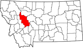
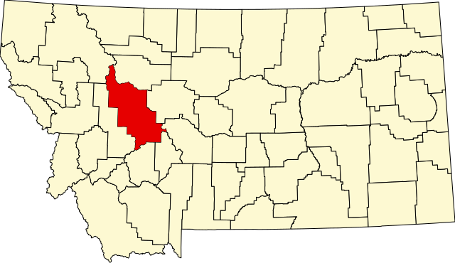
This is a locator map showing Lewis and Clark County in Montana.
| Ich, der Urheberrechtsinhaber dieses Werkes, veröffentliche es als gemeinfrei. Dies gilt weltweit. Wenn dat na lokale Rechtslaag nich mööglich is, gellt: Ich gewähre jedem das bedingungslose Recht, dieses Werk für jedweden Zweck zu nutzen, es sei denn, Bedingungen sind gesetzlich erforderlich. |
Datei-Historie
Klick op de Tiet, dat du de Datei ankieken kannst, so as se do utseeg.
| Datum/Tiet | Duumnagelbild | Grött | Bruker | Kommentoor | |
|---|---|---|---|---|---|
| aktuell | 15:30, 12. Feb. 2006 | | 9.194 × 5.303 (122 KB) | David Benbennick | {{subst:User:Dbenbenn/clm|county=Lewis and Clark County|state=Montana|type=county}} |
Dateibruuk
Disse Sied bruukt dit Bild:
Allmeen Datei-Bruuk
Disse annern Wikis bruukt disse Datei:
- Bruuk op ar.wikipedia.org
- Bruuk op bg.wikipedia.org
- Bruuk op bpy.wikipedia.org
- Bruuk op cdo.wikipedia.org
- Bruuk op ceb.wikipedia.org
- Bruuk op cy.wikipedia.org
- Bruuk op de.wikipedia.org
- Bruuk op en.wikipedia.org
- Helena, Montana
- List of counties in Montana
- Lewis and Clark County, Montana
- Augusta, Montana
- East Helena, Montana
- Helena Valley Northeast, Montana
- Helena Valley Northwest, Montana
- Helena Valley Southeast, Montana
- Helena Valley West Central, Montana
- Lincoln, Montana
- Helena West Side, Montana
- Marysville, Montana
- MacDonald Pass
- Rogers Pass (Montana)
- User:Nyttend/County templates/MT
- Template:Lewis and Clark County, Montana
- National Register of Historic Places listings in Lewis and Clark County, Montana
- Wolf Creek, Montana
- Craig, Montana
- List of lakes of Lewis and Clark County, Montana
- List of mountains in Lewis and Clark County, Montana
- Category:Populated places in Lewis and Clark County, Montana
- List of trails of Lewis and Clark County, Montana
- Rimini, Montana
- Unionville, Montana
- Canyon Creek, Montana
- Cadotte Pass
- Mike Horse, Montana
- Milford Colony, Montana
- Gilman, Montana
- York, Montana
Kiek na mehr almeen Bruuk von disse Datei.