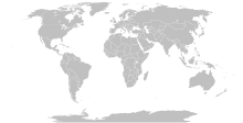
Bild:Island nations.svg

Größe der PNG-Vorschau dieser SVG-Datei: 800 × 411 Pixels. Anner Oplösungen: 320 × 164 Pixels | 640 × 329 Pixels | 1.024 × 526 Pixels | 1.280 × 657 Pixels | 2.560 × 1.314 Pixels | 863 × 443 Pixels.
Originaldatei (SVG-Datei, Utgangsgrött: 863 × 443 Pixel, Dateigrött: 1,55 MB)
Datei-Historie
Klick op de Tiet, dat du de Datei ankieken kannst, so as se do utseeg.
| Datum/Tiet | Duumnagelbild | Grött | Bruker | Kommentoor | |
|---|---|---|---|---|---|
| aktuell | 13:15, 25. Sep. 2023 |  | 863 × 443 (1,55 MB) | Seabourn101 | Reverted to version as of 22:34, 31 May 2023 (UTC) |
| 20:55, 12. Sep. 2023 |  | 863 × 443 (1,55 MB) | Taekhosong | Reverted to version as of 09:33, 1 August 2018 (UTC) | |
| 00:34, 1. Jun. 2023 |  | 863 × 443 (1,55 MB) | Przemub | Reverted to version as of 16:20, 5 April 2023 (UTC). Another land border there is the one with Akrotiri and Dhekelia, which is internationally recognised. | |
| 10:27, 7. Apr. 2023 |  | 863 × 443 (1,59 MB) | Discombobulates | Cyprus shouldn't have a land border, the TRNC is recognised only by one country, its occupier | |
| 18:20, 5. Apr. 2023 |  | 863 × 443 (1,55 MB) | Jeffhardyfan08 | wrong file | |
| 18:20, 5. Apr. 2023 |  | 1.000 × 514 (27 KB) | Jeffhardyfan08 | Added Greenland | |
| 08:38, 25. Apr. 2022 |  | 863 × 443 (1,55 MB) | Seabourn101 | Reverted to version as of 15:08, 1 September 2018 (UTC)- revert Unexplained reversion | |
| 06:26, 20. Apr. 2022 |  | 863 × 443 (1,55 MB) | Vodi.Dino.Eri | Reverted to version as of 20:31, 18 December 2015 (UTC) | |
| 17:08, 1. Sep. 2018 |  | 863 × 443 (1,55 MB) | 行到水穷处 | Reverted to version as of 16:05, 15 August 2018 (UTC) (as discussed) | |
| 16:05, 1. Sep. 2018 |  | 863 × 443 (1,55 MB) | 行到水穷处 | Reverted to version as of 09:33, 1 August 2018 (UTC) (No specific comment is provided for the last edit) |
Dateibruuk
Disse Sied bruukt dit Bild:
Allmeen Datei-Bruuk
Disse annern Wikis bruukt disse Datei:
- Bruuk op af.wikipedia.org
- Bruuk op ar.wikipedia.org
- Bruuk op az.wikipedia.org
- Bruuk op bn.wikipedia.org
- Bruuk op bs.wikipedia.org
- Bruuk op ca.wikipedia.org
- Bruuk op ckb.wikipedia.org
- Bruuk op da.wikipedia.org
- Bruuk op de.wikipedia.org
- Bruuk op en.wikipedia.org
- Bruuk op eo.wikipedia.org
- Bruuk op et.wikipedia.org
- Bruuk op eu.wikipedia.org
- Bruuk op fa.wikipedia.org
- Bruuk op fa.wikibooks.org
- Bruuk op fi.wikipedia.org
- Bruuk op fr.wikipedia.org
- Bruuk op fr.wiktionary.org
- Bruuk op gag.wikipedia.org
- Bruuk op gl.wikipedia.org
- Bruuk op he.wikipedia.org
- Bruuk op hi.wikipedia.org
- Bruuk op hu.wikipedia.org
- Bruuk op ia.wikipedia.org
- Bruuk op id.wikipedia.org
- Bruuk op ig.wikipedia.org
- Bruuk op ilo.wikipedia.org
- Bruuk op inh.wikipedia.org
- Bruuk op is.wiktionary.org
- Bruuk op it.wikipedia.org
- Bruuk op ja.wikipedia.org
- Bruuk op ko.wikipedia.org
- Bruuk op la.wikipedia.org
Kiek na mehr almeen Bruuk von disse Datei.


